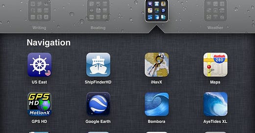
iPad apps for boaters
Less than six months after the release of the first iPad, I wrote an article that looked at what I considered to be the best boating apps for the iPad. Over the last 18 months, I've used many of those apps and others as I have recently returned from a 1600 mile cruise on my own boat, as well as a crewing gig on the Caribbean 1500 – all with my iPad. Now that the third incarnation of the iPad has been released and dubbed the New iPad, I decided it was time to reevaluate what apps are available based on my recent experience of cruising with my iPad.
The biggest change in the app market for handheld devices is the entrance of apps that connect to NMEA data via wifi and TCIP. Rich Ray at GPSNavX had already implemented this feature with his Mac laptop navigation software when the first iPads came to market, but now many developers, including Rich with iNavX, have brought this capability to the world of iOS. This allows data from instruments like wind and speed, as well as AIS and radar to be streamed to a laptop over ethernet or over wifi to an iOS device. In the section on data apps, I'll look at several apps that are using this feature, and in the accessories section, I'll point out a few of the devices that can help you get your NMEA data from your boat's network to your various i-devices. The next best improvement in the app scene is in the weather apps. In the first six months of the iPad's life, there weren't really any great weather apps for sailors. Boy, has that ever changed. Check out some of the neat new apps in the weather section. So, here are what I consider to be the most interesting apps in these categories:
Navigation Apps
As soon as you start to get involved with electronic navigation, you learn that there are two types of charts: raster charts which are digital versions of the paper charts and do not change as you zoom in and out, and vector charts which can have more imbedded data and display different information depending on the zoom level. Vector charts also tend to knit together more seamlessly as you travel across the border from one chart to another. Charts of both types for the US waters are available for free from NOAA and some of the navigation apps include those charts. However, most navigation apps are made by the companies that make their own proprietary charts – i.e. Navionics, Imray, Garmin, etc.

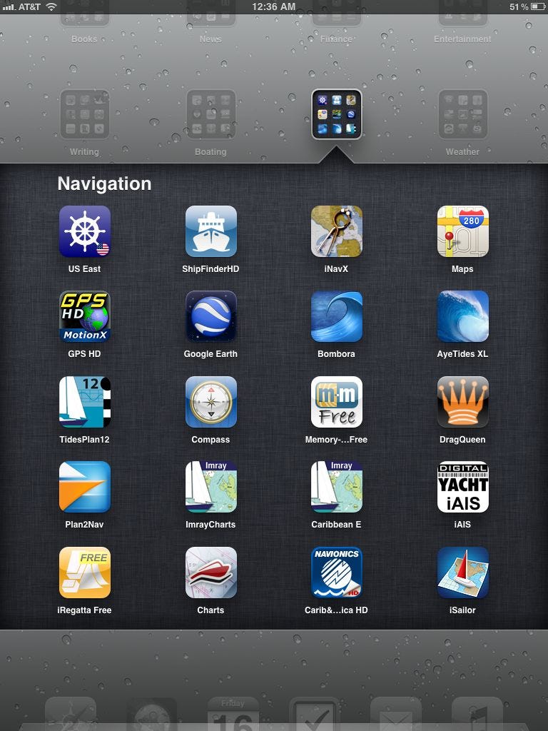
iNavX – ($49.99 includes free NOAA charts, plus many charts available for purchase) When I bought my iPad in May 2010, I started counting the days until the first iPad version of this app was available. I have been using it ever since as my primary navigation tool on the iPad. Although I have tried many other navigation apps, I always keep coming back to this one as it has the most features with the cleanest, most intuitive interface. The iNavX program is not married to any particular cartography and this is just one of its many strengths. The customer is able to purchase a wide variety of charts through the X-Traverse online chart store after registering and paying the $10 fee. For example, I have the raster charts for the Bahamas from NV and the vector charts from Navionics. I can open either one in this iNavX app. This chart has all the usual chart plotter functions, i.e. waypoints, routes, tracks, compass, distance and bearing,and it has a terrific banner that displays the top of the chart that shows all the instrument data. It now also supports a heads up display, although on the ICW's twists and turns, I found that view made me dizzy. I prefer north-up. I enjoy being able to see my location on the chart graphically at the same time I check my Course, Speed, Distance to Waypoint and Estimated Time of Arrival at the top of the chart. In addition, on the Forecast page, you can send for GRIB charts via email and link to the Tides program, AyeTides XL. What really makes this app stand apart from the others is in the ability to access NMEA data that can be transmitted over your wifi network via a multiplexor, and thus the program can display AIS data and a whole slew of other instruments like engine instruments, wind and depth, and it can even connect to a networked autopilot. The negative side of this app is the high price of the app and then the additional cost of charts and a tides app. However, once you have the whole package set up, it is difficult to go back to using the less expensive apps.
Imray Chart Navigator
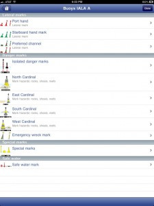
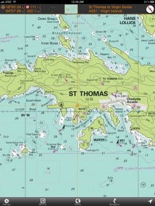
Imray Chart Symbols Marine Imray Chart Navigator App – ($42.99 - 47.99 per region, includes charts) This is another of the apps that includes the navigation app with each individual region. To date, they cover these seven regions: Eastern Caribbean, Atlantic Europe, West UK and Ireland, North Sea, Western Mediterranean, English Channel and The Netherlands. The plus here is that these are the award-winning and highly regarded raster charts from Imray-Iolaire, the charts that benefit from the vast knowledge of Donald Street. I evaluated the Caribbean version which includes 127 charts, which have been updated to February 2011. These charts are gorgeous. Most of the Caribbean cartography in other chart applications is based on government charts from the country in question, so British, US, French and Dutch charts provide the basis for the sailor's charts. Government charts are created with the needs of shipping in mind and often don't have the detail in the areas cruisers want to go. The Imray folks pride themselves on providing charts, apps and cruising guides "written by sailors for sailors." The app includes waypoint management, routes (and they can be shared via email), a beautiful compass overlay, distance and bearings from any point, integrated tide tables, and in some cases aerial photographs. They have a nice YouTube introduction to the product here. While I do like to use vector charts, I enjoy having access to both to plan my routes and compare the differences in the charts. I would definitely recommend this product. Jeppesen Marine Plan2Nav – (Free app, charts for Eastern US & Bahamas $29.99) Jeppesen has designed their app as a free app with a basic chart, but real charts forth using must be purchased within the app. However, I was able to use most of the features within the basic app in order to evaluate it. Theoretically, though, the best part of this program would be the fact that it uses C-Map charts which I have found to be extremely accurate. Reportedly, C-Map bases their Bahamas charts on the much-loved Bahamas Explorer Charts. This program brings C-Map cartography to the iPad for the first time, and the app makes good use of the multi-touch gestures to zoom, rotate and tilt charts. The app includes the usual chart plotter functions of waypoints (called favorites in this app), routes, distances and bearings, GoTo functionality and an anchor alarm. The most unique feature of the app is that it can download weather from the Internet and overlay wind, wave, temperature and humidity information on the chart and then animate how it is forecast to change over the next 3-4 days. Charts&Tides (US East) – I used this Navimatics app quite a bit during my trip down the ICW not because of their seamless NOAA vector charts, but because of the Active Captainintegration.
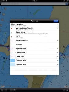
Charts and Tides Like the Imray app, this app includes the charts and there are four different regions that cover the US. I don't care much for the look of the charts or the icons the charts use for information, but the user-generated content from Active Captain made this app an essential one for my own navigation app library. In the settings, users can go in when wifi is available and update the Active Captain information and download up-to-the-minute information, fuel prices, hazards, marina and anchorage reviews, etc. from the AC servers. The entire database resides in the app, so although this information can be found for free on the Active Captain website, they use flash and the charts don't appear on i-devices without third party help. The app does allow the creation of waypoints and has a GOTO function, and there is an excellent search mode for finding marinas, bridges, etc. quickly. Also, Charts & Tides includes integrated tides, weather and sun and moon calendar, but it is the Active Captain data that makes this app a recommended buy. Earth NC – ($19.99) This app is somewhat new to the marine market, and at first I thought that it added little that was new. It uses NOAA raster charts that can be downloaded and stored offline like several of the other apps, and it allows creation of waypoints and tracking, called trips here. But this app does add several new features. Instead of Active Captain data, Earth NC links to CruisersNet.Net , Marinalife.com, or the Waterway Guide, and it can populate the charts with Points of Interest that equate to marinas, bridges, etc. On the POI menu, users have access to a preselected list of tidal station around the current GPS location. Marinas can be viewed in list form as well as location icons on the charts. Not only that, this app has a weather function that will give reports from airports and buoys in the vicinity. It can also overlay Nexrad radar on the charts. Users can select topo map overlays or switch to satellite view. For the price, this app offers tons of information, and while I wouldn't choose to use it as my primary navigation program, it certainly has a place in my app library for trip planning. That's where it shines. Navionics Marine&Lakes: US&Canada HD – ($49.99 or $34.99 for US only) I have used the Navionics vector charts in iNavX for several years and for the most part, I like them. For that reason, I was looking forward to trying out this app. While it does have some interesting features, I found the interface to be extremely difficult to figure out and there is no user's guide that I can find. When I clicked on the Settings button, I found a link to a tutorial, but when I tapped it, I was taken to a screen with one link to add additional maps. I'd already done that, and as a mariner, red flags go up when a marine app calls them maps instead of charts. I wanted to work through route building and waypoint creation and the only instructions I could find were buried in among the website's FAQ's. By trial and error, I finally created a route and figured out how to view the statistics such as the distance of each leg. By inputting my cruising speed, the app allowed me to calculate the total time required and I could input my fuel consumption to see how many gallons I would burn. However, there was no place I could find where I could activate that route and see my own vessel's progress on the route. No GOTO function, no course corrections to get back on the route, and no way to enter waypoints or see a list of waypoints other than by tapping the chart to form the legs on a route or searching by lat and long in the search field. In terms of this being used as a real navigation program, this is a major fail in my book. In addition, according to the FAQ's on the website, the mobile app only displays range and bearing when you reach a speed higher than 5 knots. This does not do sailboats much good, nor does it help a vessel slowly creeping into a dark harbor at night. However, the app does have lots of other auxiliary functions that provide information for planning trips. It has a newsstand feature where users can read articles about boating. And they have a new feature that offers User Generated Content (UGC) where users can save and share their own chart markings with all the other folks using Navionics charts on chart plotters, i-devices and laptops. Perhaps, if they can add a goto function in the future, this will grow into a terrific app. BlueChart Marine Mobile App – (price unknown) Garmin and Active Captain both began advertising this app at the Miami Boat Show, but the debut was jumping the gun a bit, as Garmin expects that this app will not be for sale in the App Store until sometime in the summer of 2012. For folks who already have a Garmin chart plotter, this will be interesting as the app has the ability to wirelessly transfer routes, waypoints and tracks to a networked Garmin chart plotter, assuming one has the ability to broadcast NMEA data wirelessly. My guess is that Garmin will be bringing to market another little black box to do just that. The app brings Garmin's vector charts to iOS devices for the first time. Also, the user-generated content from Active Captain is a very valuable addition. I look forward to seeing this product when it is released.
Weather Apps
There is nothing that impacts boaters' quality of life quite so much as weather. With better information, we can make better decisions, but the science or, as some would say, art of weather forecasting a topic for debate any time boaters gather. Are you better off with GRIB charts or weather fax data? Should you make your own forecast or trust others? Likewise, app developers have quite different opinions about what should be featured in their apps. Lucky for us, that means we are starting to see some really good and varied weather apps. Weather 4D Pro – ($30.99) Yes, the price is hefty, but there is a non-pro version for only $5.99. This is a really beautiful and intuitive app for downloading and viewing GRIB charts. The GRIB data is displayed on gorgeous satellite photos of the world. Those of us who are just finding our way around these weather apps will really appreciate the intuitive interface with buttons that make sense and stay the same from screen to screen. Users can copy and paste GRIB files, share them with other applications, and send them by email. The real strength of this app lies in its ability to overlay several GRIB charts and then automate them to play out over a specified period. This really helps you to see how the various aspects of wind, pressure, temperature, precipitation and wave height are being forecasted to interact. And the graphics in this program are really beautiful, taking full advantage of the iOS device's high resolution screens. The app uses NOAA's GRS model and the FNMOC WW3 model for wave heights, and unlike the other apps, it will display both at the same time. The screen can look a bit crowded with all that data, but it is instructive to watch how the forecast plays out over 8 days. However, if you are familiar with watching the various forecasted hurricane tracks during the season, you are well aware how all the different models sometimes disagree in their forecasts, so wise mariners take these long-range forecasts with several grains of salt. The fact that this app only includes those two models, however, is a drawback. Weather Track – ($19.99) The developers of this app, a cruising couple who wanted to have a GRIB viewing app and couldn't find one, have nick-named their app "The Swiss Army Knife for Weather Enthusiasts." There is a great deal that this app can do, but it is not all that intuitive and I found the learning curve to a bit steep compared to some other apps. However, that complexity can also be seen as a plus for this app. There is more weather information at your fingertips in the app than with any other I have seen. First off, this is the only GRIB viewer I found that allows users to download GRIBs from as many different models. You can choose from GFS, COAMPS, NOGAPS, WW3 (waves), RTOFS (currents), and a couple of others that cover the area around the Med. The developers set the app up using Sailmail's servers for their GRIB access, so when on passages and unable to use the Internet to download files, users can download the files via SSB and Pactor modem, and then transfer them to the iPad either by email or wired transfer. There won't be any format issues. Like other GRIB viewers, these files can also be animated via updates every three hours for up to 8 days (most models). To decrease the size of downloads, this app lets you input a track with speed and distance and it will only download the weather date for the area you expect to be traveling. One drawback of this app is that the different GRIBs for wind or waves or pressure can only be looked at one by one on the chart, they cannot be layered onto the same page. However, they do have a view called the Meteogram that gives a view of all the meteorological data in graph form. In any GRIB view, just tap on a location on the chart and it will bring up the Meteogram for that position. This app also has a page with links to Weather Online and from there users can view WeatherFax charts, satellite charts and many other excellent weather web sites. Finally, inside the information and help section of the app there is a good explanation of how to use the app and clear explanations for what one can find on each of the different weather models and their origins. Weather Track truly is a Swiss Army Knife of weather apps. Pocket Grib – ($5.99) This Grib viewer is simple and sweet, intuitive and easy to use. It incorporates many of the better features of the other viewers, and yet is easy to navigate with five clear keys across the bottom of the page. Users have the choice of five different weather models here, and the settings key also permits you to choose which parameters you want to view on the charts. The weather data is overlaid onto Google maps. The GRIB files can be animated, too. However, since the wave height and wind speed are in two different downloads, this viewer will not let you view both overlaid onto the map. I especially liked how you could place a key for weather symbols on the chart and the barbed wind arrows can be color coded for those of us who don't see tiny symbols so well anymore. This is great as entry-level GRIB viewer that won't overwhelm users, yet still packs plenty of information. WeatherFax HD – ($4.99) This app lets you view all the National Weather Service's high seas weather maps right on your iPad or iPhone. The beauty of these maps is that they have the weather systems like fronts, highs and lows drawn onto the maps in addition to the pressure isobar lines. These maps work great together with the Grib charts to get a total weather picture. For this app, the weather fax charts are delivered via an Internet connection, either wifi or 3G, so it is a coastal app only. However, the ease of use is fantastic. You select which broadcast station suits your needs, and then you can download all the charts available. However, this app will only work as long as you have an Internet connection. HF Weather Fax – ($2.99) Living on a small boat, you've got to love any app that lets you get rid of a device and go paperless. Remember the old days with the paper weather fax machines attached to your SSB? Now you can chuck that big clunky printer. Tune your SSB to the weather fax frequency, and then set the iPad next to the radio's speaker or headphones. This app will translate the digital information in that audio stream and display the weather fax images on your i-device screen. The app includes a list of the NOAA/NWS radio weather fax schedule. While the WeatherFax HD app mentioned above is great while you are connected to the Internet via wifi or 3G, this app lets you get weather information at sea if you have an SSB. BuoyData – ($1.99) I grew to LOVE this app on my trip up and down the US coast. It is essentially just a gateway to finding weather information on the Nationa Weather Service website, but if you have ever tried to find what you want on their site, you know how difficult that can be. The app uses the iPad's built-in GPS to locate Nearby Buoys and then it offers up a list from which you can select the one you want. Next to the name of each buoy is a mini weather snapshot with wind speed and direction and it helps you start forming a picture of what the area weather is like around you. Then you can select a buoy and tap through to get a short forecast for the area and with another click you get the National Weather Service's extended forecast page for that location. An additional tap will bring up the NWS radar. If you don't want to have to read GRIB charts or weather faxes and you want a forecast for your area in easy to understand plain English, this is a great app.
Sailing and Boating Apps
I mentioned several apps here last time around for tying knots and other applications. I will only include a few additional apps I have come to appreciate recently. iRegatta – ($9.99) On their website Let's Create has an easy-to-understand description of how this app can be used in a race. For the start, there is a graphic of a timer and the starting line. The ends of that starting line can be input either from sailing to that location and pressing the according flag button or by the manual input of GPS positions. The wind direction can put entered manually, or if the app is receiving NMEA data, the information can be live from the instruments at the head of the mast. The app will then show which end of the line is favored. The starting clock can be started, paused and synchronized. Once the start clock hits zero, the app automatically switches to the main view. Navigation Rules Pro – ($4.99) Just what it says, this app is a great, easy-to-use compendium of navigation rules, lights, signals and general information about everything from locking procedures to man overboard drills. Ship Captain's Medical Guide - ($4.99) This app contains over 1,100 pages of content developed by the UK's Maritime and Coastguard Agency and is intended for use aboard ships where no doctor is carried - in other words, this is an über first aid manual.
Marine Data and AIS Apps
Digital Yacht AIS – (Free) Assuming you have the Digital Yacht iAIS wifi device listed under accessories, this app will display your AIS information for you. iOnboard – ($6.99) This program from Digital Yacht assumes you have a wifi network on board to which you are able to connect your NMEA data. Digital Yacht also sells hardware to make this possible. With this app, you can display GPS position, wind, boat speed, and depth on your iPad instead of or in addition to other instruments on the boat. MarineTraffic – ($3.99)This app displays AIS data that is broadcast over the Internet. Marinetraffic.com is a website where you can view the same data, but it is certainly easier to use this app. Inside the app there is a photo gallery with more than 700,000 pictures of vessels, ports and lighthouses. For coastwise boaters with 3G access, this is a great app.
Accessories
To understand why it is necessary to add a multiplexer into your system, take a look at this graphic. Several of these multiplexers are still only working with NMEA 0183. If shopping for a unit, be sure to find out what NMEA standard(s) your boat has and talk to the vendors to make sure your unit can do one or both if that's what you need. Shipmodule Miniplex 2wi – ($460-$500) This NMEA multiplexer can combine up to four navigation instruments into two NMEA outputs. It can also output that info via wifi. It also has a USB port that can be used to output data for the laptop navigation programs and to update the firmware on the multiplexer. Brookhouse iMux – Brookhouse says they have temporarily stopped shipping this multiplexer. I don't know what the gossip is behind that, and if they have gone out of business, but it has been touted as a good unit. DigitalYacht iAIS WiFi receiver & multiplexer – ($460-$500) This is another bit of a Swiss Army Knife of a unit: it is an AIS receiver, a wifi router and a multiplexer. XGPS150A Universal Bluetooth GPS Receiver – ($99.00) This is a small GPS receiver that operates on Bluetooth and can connect to an iPad, iPhone or laptop. I would love to get one to free up a USB port on my laptop. Universal Tablet Holder – ($39.95) I bought this tablet holder from Zarcor at the Annapolis Boat Show, and it was the best $40.00 I ever spent. It mounts on the stainless tubing over my binnacle and is on a swivel so I can angle the tablet for the best daylight viewing angle. The pairs of feet are spring loaded and they will grab the iPad in the waterproof case I have or without it. I think this holder would work with just about any case. I have a cigarette type 12V plug right by my helm and the cord reaches easily from this holder. This holder really makes your iPad perform just like a helm-mounted chart plotter. Dry Case – ($40 - $50) Waterproof vacuum-sealed cases for iPhone and iPad. Waterproof to 100 feet. Includes a jack for headphones. Fun stuff ISuper Helicopter – (free app, but the helicopter will cost you $60- $100) This is the first RC helicopter that uses an iPhone or iPad as the remote controller. Since it uses Bluetooth technology, 60 feet is about the maximum controllable distance. I could just see tying a Go Pro video camera to this baby and sending it up to get a good look at what's going on at the top of my mast or getting some nice fly-over video of my boat under sail. Smart Baby Monitor – Essentially, this is a web cam that uses your i-Phone or i-Pad as a monitor through an app instead of over the Internet. Imagine having this video camera set up in your boat when you are away, so you can always take a look to see how your "baby" is doing. Or set it up when you are at the office and your mechanic is supposed to be working in the boat. Both the camera and the iOS device require a wifi or ethernet connection to the Internet at their separate locations, but most any boat owner would enjoy being able to check on his or her boat in real time on an i-device (thanks to Ben on Panbo for writing about this one). Sailing and Boating Community – (free) CruisersForum.com is an online community where boaters can go for friendship, support and information. Using this app makes it much easier to follow those hot discussion topics while on the go. Choice of Broadsides – (free) Game that will take you back to the days of Hornblower. See if you can earn your Admiral's hat.
I selected this post to be featured on my blog's page at Sailing Blogs.

